"Competitively priced service, the agent I dealt with was very helpful. On the day of the survey itself I received a call from the surveyor to run through his initial findings. The quality of the report produced was excellent, very detailed and thorough. If needed I will be using SAM Conveyancing's services again in the future for sure."


Local Building Survey Clifton
Our Building Surveyors specialise in the local area and have completed house surveys in Stoke Bishop, Redcliffe, St Andrew's, St Pauls, Redland , Sneyd Park and Cotham.
We work with specialist RICS Building Surveyors to undertake Home Buyers Surveys in Clifton. Whether you are buying an old run down 'doer upper' or standard construction freehold house, our RICS surveyors have seen them all.
With a vast number of years of experience completing building surveys on properties in Clifton we'll be able to give you the detailed Clifton HomeBuyers report that you will need to know and what defects there are with your property.
Defects flagged in a Clifton Home Buyers Survey

Local Tip: Subsidence

Local Tip: Damp
According to the UK Government's Public Health England, Clifton is in an area where there are raised levels of Radon. Areas including Pembroke Road and Upper Belgrave Road have a maximum radon potential of 10 - 30%
Properties within these areas have a higher chance than average of experiencing ground radon emissions.

Local Tip: Asbestos
Raised levels of noise pollution from roads in Clifton are mainly due to the A4 traffic affecting properties in nearby streets such as Northcote Lane Whiteladies Road and Pembroke Road.
Types of property in Clifton?
Why Choose SAM Conveyancing for your Home Survey?
In helping over 15,339 survey clients since 2014, we've learned a lot about surveys in Clifton using our panel of over 100 Royal Institution of Chartered Surveyors (RICS). Your Clifton surveyor will be local to your property, so whether you're worried about subsidence, damp, infestations, extensions, or even just for peace of mind, we've got you covered.
Our HomeBuyers Survey costs are fixed and competitive, as you'll see from all our Excellent reviews on Trustpilot. This means you don't have to break the bank to get a full health check on your new home. Get a Home Buyer Survey Quote today, or if you're not sure which survey to choose and want to know the difference between a Level 2 Home Survey and a Level 3 Building Survey, then give us a cal,l and we'll happily tell you what you need - 0333 344 3234 (local call charges apply).
What defects are flagged in a Homebuyer's Survey?

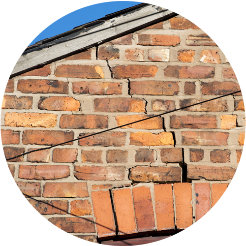
Cracks are inspected and in the report will confirm if you need a structural engineer as there are signs of historical or current movement.
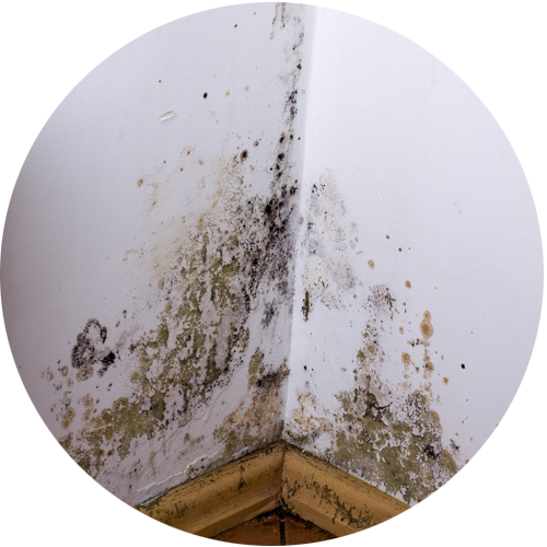
The RICS surveyor will use a moisture meter in the rooms and report any high levels along with any mould or damp causing damage to the walls/windows.
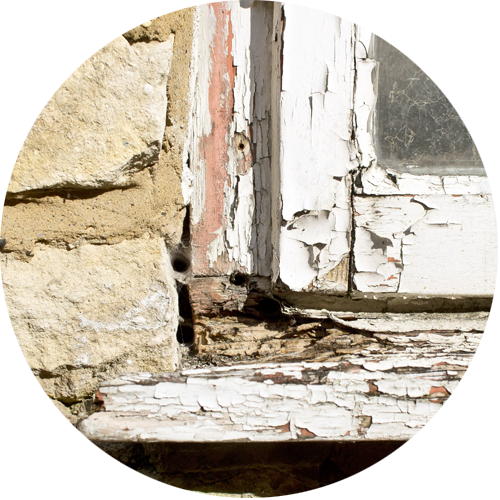
The wooden door frames and windows will be inspected for rotting and wood worm.

The surveyor looks for signs of infestations through droppings, damage to piping/flooring and in some cases finding where the nest is.

The surveyor will check the grounds of the property and, where possible, check over the fences to neighbouring plots to identify if there is a risk of Japanese knotweed.
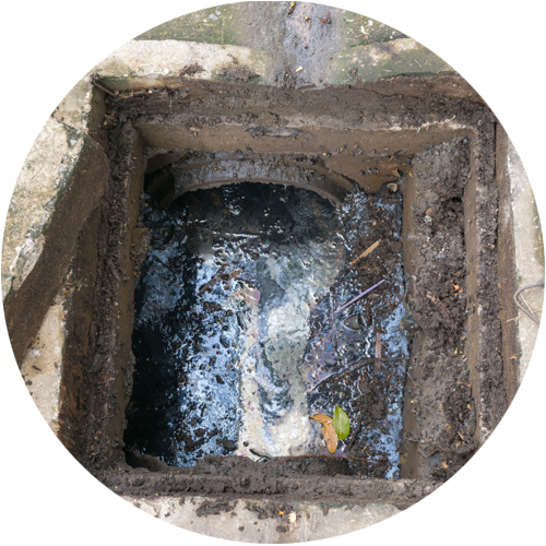
The surveyor lifts up accessible man hole covers to check if the drains are blocked. You may need to get your drains inspected with CCTV.
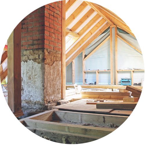
The surveyor will enter into the roof/loft space if there is a safe and accessible ladder. They'll look for insulation, signs of leaking and and damage.


Average Cost of Building Surveyor in 2026 in Clifton
The cost varies depending on the size and condition of the property, with the average cost of our HomeBuyers Survey starting at £375 EXC VAT. The average cost of a Building Survey is higher. Our fixed fees start at £499 EXC VAT.
To ensure accuracy, we utilise Rightmove or Zoopla to assess the property type, guaranteeing a fixed quote tailored to your needs. For guidance on choosing the right survey, contact our survey specialists at 0333 344 3234.
Thinking of moving to Clifton?
Clifton, a suburb of Bristol, has upscale restaurants and bars around Whiteladies Road. Within its area, there are also popular places, including Clifton Suspension Bridge and Clifton Cathedral.
Frequently Asked Questions: Homebuyers Survey Clifton
- online checklists
- videos
- free downloads
- useful tips
RICS Level 2 Home Survey with a Valuation
A RICS Level 2 Home Survey, which used to be called the HomeBuyer Report or a Home Buyer Survey, is generally suitable for:
- Bungalows
- Flats
- Standard construction houses
The majority of Clifton's leasehold flats require only a RICS HomeBuyer Report but for any Victorian conversions, a Building Survey may well be required.
RICS Level 3 Building Survey
A Level 3 Home Survey, also known as a Building Survey or a full structural, is the most comprehensive visual inspection a RICS surveyor can provide on a property in Clifton. It is suitable for:
- complex buildings, for example those that have been extensively extended and altered
- unique or older historic properties
- properties in poor condition; or
- those where the client is planning to carry out extensive repair and refurbishment work.
Speak to one of our team on 0333 344 3234 to find out if your property suits a RICS Building Survey, or read our article Which Home Buyers Survey suits your property .