"Competitively priced service, the agent I dealt with was very helpful. On the day of the survey itself I received a call from the surveyor to run through his initial findings. The quality of the report produced was excellent, very detailed and thorough. If needed I will be using SAM Conveyancing's services again in the future for sure."


Local Building Survey Cobham
Our Building Surveyors specialise in the local area and have completed house surveys in Guildford, Byfleet, Weybridge, Hersham, Esher, Mayford and East Horsley.
We work with specialist RICS Building Surveyors to undertake Home Buyers Surveys in Cobham. Whether you are buying an old run down 'doer upper' or standard construction freehold house, our RICS surveyors have seen them all.
With a vast number of years of experience completing building surveys on properties in Cobham we'll be able to give you the detailed Cobham HomeBuyers report that you will need to know and what defects there are with your property.
Defects flagged in a Cobham Home Buyers Survey

Local Tip: Subsidence

Local Tip: Damp
Some properties in Cobham may be located in an area which is subject to a Community Infrastructure Levy (CIL).
The Community Infrastructure Levy is a planning charge, introduced by the Planning Act 2008 as a tool for local authorities in England and Wales to help deliver infrastructure to support the development of their area. It came into force on 6 April 2010 through the Community Infrastructure Levy Regulations 2010. Development may be liable for a charge under the Community Infrastructure Levy (CIL), if your local planning authority has chosen to set a charge in its area.
Click to find out more about the Community Infrastructure Levy(CIL).

Local Tip: Asbestos
Raised levels of noise pollution from roads are particularly notable around the intersection of the M25 and the A3 in the Cobham area.
Types of property in Cobham?
A 1960s improvement scheme resulted in a widening of the High Street which resulted in a few historic buildings being demolished, with the shops replacing them often having glass fronts.
Soils are slowly permeable, seasonally wet, slightly acid but base-rich loamy and clayey. Most properties, barring the odd period surviving homes from the Victorian and Edwardian era, are comparatively modern and there are many semi-detached houses.
There are new build developments, such as the low-rise flats in Portsmouth Road and larger modern family homes around, particularly in Fairbourne.
Cobham also has many retirement homes, such as Churchfield House, Cobham Grange, Cobham Park and Winstanley Close/Walk (in Lushington Drive).
Why Choose SAM Conveyancing for your Home Survey?
In helping over 15,339 survey clients since 2014, we've learned a lot about surveys in Cobham using our panel of over 100 Royal Institution of Chartered Surveyors (RICS). Your Cobham surveyor will be local to your property, so whether you're worried about subsidence, damp, infestations, extensions, or even just for peace of mind, we've got you covered.
Our HomeBuyers Survey costs are fixed and competitive, as you'll see from all our Excellent reviews on Trustpilot. This means you don't have to break the bank to get a full health check on your new home. Get a Home Buyer Survey Quote today, or if you're not sure which survey to choose and want to know the difference between a Level 2 Home Survey and a Level 3 Building Survey, then give us a cal,l and we'll happily tell you what you need - 01483 802 485 (local call charges apply).
What defects are flagged in a Homebuyer's Survey?

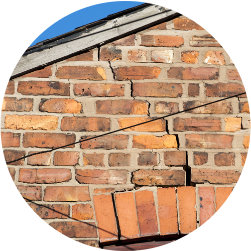
Cracks are inspected and in the report will confirm if you need a structural engineer as there are signs of historical or current movement.
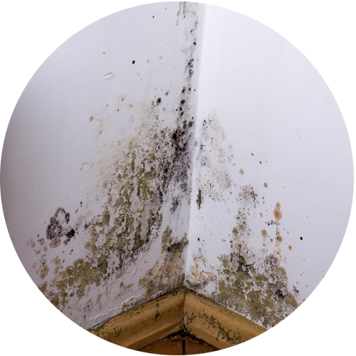
The RICS surveyor will use a moisture meter in the rooms and report any high levels along with any mould or damp causing damage to the walls/windows.
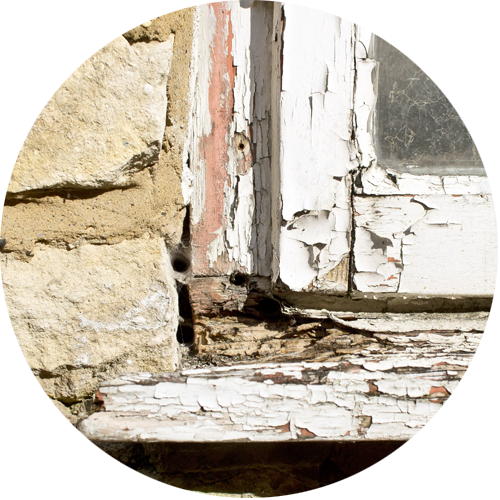
The wooden door frames and windows will be inspected for rotting and wood worm.

The surveyor looks for signs of infestations through droppings, damage to piping/flooring and in some cases finding where the nest is.

The surveyor will check the grounds of the property and, where possible, check over the fences to neighbouring plots to identify if there is a risk of Japanese knotweed.
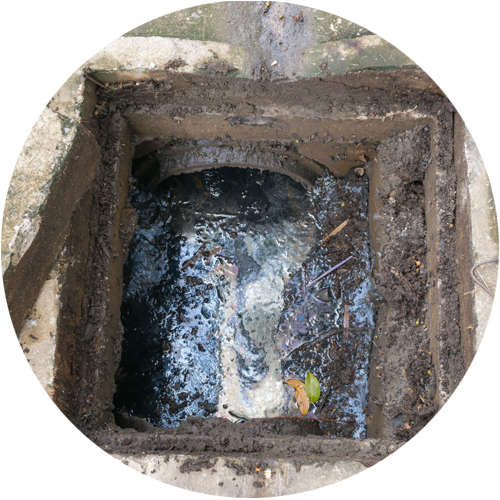
The surveyor lifts up accessible man hole covers to check if the drains are blocked. You may need to get your drains inspected with CCTV.
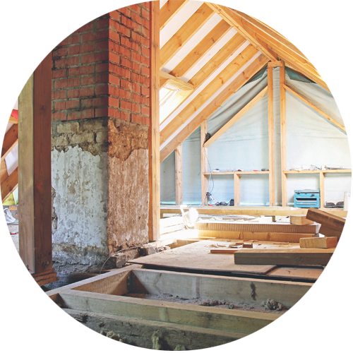
The surveyor will enter into the roof/loft space if there is a safe and accessible ladder. They'll look for insulation, signs of leaking and and damage.


Average Cost of Building Surveyor in 2026 in Cobham
The cost varies depending on the size and condition of the property, with the average cost of our HomeBuyers Survey starting at £375 EXC VAT. The average cost of a Building Survey is higher. Our fixed fees start at £499 EXC VAT.
To ensure accuracy, we utilise Rightmove or Zoopla to assess the property type, guaranteeing a fixed quote tailored to your needs. For guidance on choosing the right survey, contact our survey specialists at 01483 802 485.
Thinking of moving to Cobham?
Cobham is a village in Elmbridge Borough in Surrey, 17 miles south-west of London and 10 miles from Guildford. There are a number of primary and private schools in the locale and a landscape park called Painshill Landscape Park. Brooklands Museum, featuring aeronautical, car, motorbike and bike exhibits, is within easy reach, as is Chessington World of Adventures, with its theme park and zoo.
Frequently Asked Questions: Homebuyers Survey Cobham
- online checklists
- videos
- free downloads
- useful tips
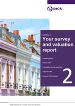
RICS Level 2 Home Survey with a Valuation
A RICS Level 2 Home Survey, which used to be called the HomeBuyer Report or a Home Buyer Survey, is generally suitable for:
- Bungalows
- Flats
- Standard construction houses
The majority of Cobham's leasehold flats require only a RICS HomeBuyer Report but for any Victorian conversions, a Building Survey may well be required.
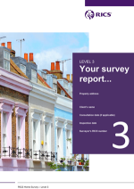
RICS Level 3 Building Survey
A Level 3 Home Survey, also known as a Building Survey or a full structural, is the most comprehensive visual inspection a RICS surveyor can provide on a property in Cobham. It is suitable for:
- complex buildings, for example those that have been extensively extended and altered
- unique or older historic properties
- properties in poor condition; or
- those where the client is planning to carry out extensive repair and refurbishment work.
Speak to one of our team on 01483 802 485 to find out if your property suits a RICS Building Survey, or read our article Which Home Buyers Survey suits your property .